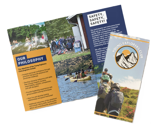
Family Picnic Areas Near Basel
Top 10 family-friendly picnic spots within 60 km of Basel — travel times, facilities, playgrounds, BBQ & dog rules.
Top 10 family-friendly picnic areas within 60 km of Basel
We list the top 10 picnic spots suitable for families within a 60 km radius of Basel. Options range from quick city breaks to half-day scenic outings; typical travel times are under about 90 minutes. Each site below has the same profile fields so you can compare quickly: travel times, parking, stroller/wheelchair access, toilets, drinking water, playgrounds, shade and a short safety note. We also note BBQ rules, dog rules and seasonality.
How we grouped the picks
- 0–5 km — city parks and close urban green spaces.
- 5–20 km — near suburbs and short drives/public-transport trips.
- 20–60 km — half-day or scenic destinations that still fit a day trip.
Quick reminders before you go
- Verify timetables and parking (use SBB for public transport): https://www.sbb.ch
- Check local rules for BBQs, open fires and dogs — municipal rules vary.
- Confirm facilities (toilets, drinking water, lifeguards, AEDs) — on-site conditions can change seasonally.
0–5 km (city)
Kannenfeldpark (Basel)
- Travel times: Car ~5–10 min from Basel city centre; PT 5–15 min by tram/bus.
- Parking: Nearby street parking and public car parks; can be limited on weekends.
- Stroller/wheelchair access: Mostly good — paved paths and flat lawns.
- Toilets: On-site public toilets (check opening hours).
- Drinking water: Drinking fountains present in parts of the park.
- Playgrounds: Large playground area suitable for toddlers and older kids.
- Shade: Mature trees provide ample shade.
- Safety note: Urban park — normal city precautions; watch small kids near paths and playground equipment.
- BBQ rules: Often no open fires except at designated sites — check city rules before lighting a grill.
- Dog rules: Dogs usually allowed but must be kept on a lead in parts of the park; confirm local signage.
- Seasonality: Good spring–autumn; busy on summer weekends.
Merian Gärten (Botanical & family lawns)
- Travel times: Car 5–10 min; PT 10–20 min by tram/bus.
- Parking: Paid parking nearby; limited free street parking.
- Stroller/wheelchair access: Very good — accessible paths through gardens and lawns.
- Toilets: Public toilets and baby-changing facilities at the garden centre/café.
- Drinking water: Water fountains and café service.
- Playgrounds: Small play areas and open lawns for running games.
- Shade: Mix of open sunlit lawns and shaded garden areas.
- Safety note: Botanical displays should not be trampled; supervise kids around plant beds and ponds.
- BBQ rules: Generally no open BBQs on the lawns — use designated picnic spots if available.
- Dog rules: Dogs often restricted in botanical zones; keep on a lead and follow signs.
- Seasonality: Best May–September when gardens are in bloom; café seasonal opening times may apply.
Schützenmattpark
- Travel times: Car ~5–10 min; PT 10–20 min by tram/bus.
- Parking: Nearby street parking and parking garages.
- Stroller/wheelchair access: Good on main paths; some grassy slopes may be steeper.
- Toilets: Public toilets in/near the park.
- Drinking water: Water fountains or nearby kiosks/cafés.
- Playgrounds: Large playground and open play spaces.
- Shade: Trees and pergolas offer shade zones.
- Safety note: Central city park — be aware of cyclists on paths.
- BBQ rules: Typically restricted; use designated BBQ areas if provided.
- Dog rules: Dogs allowed but may need to be on a lead in play areas.
- Seasonality: Popular in warm months — expect crowds on sunny weekends.
5–20 km (near suburbs)
Birsfelden Rheinpark (riverside)
- Travel times: Car 15–20 min from central Basel; PT 20–35 min by tram/train.
- Parking: Several parking zones and street parking near park entrances.
- Stroller/wheelchair access: Good on paved riverside paths; some grassy areas may be uneven.
- Toilets: Public toilets available seasonally.
- Drinking water: Drinking fountains in parts of the park.
- Playgrounds: Play structures and open spaces for bikes and scooters.
- Shade: Tree-lined areas provide shaded benches.
- Safety note: Strong river currents — do not let children near the water unsupervised; swimming usually not recommended near the dam.
- BBQ rules: Open fires usually prohibited; designated gas BBQs or municipal sites only.
- Dog rules: Dogs allowed but keep on a lead near paths and water; clean up after pets.
- Seasonality: Best spring–early autumn; weather-dependent.
Reinacher Weiher & Reinacherheide (Reinach BL)
- Travel times: Car 15–20 min; PT 20–35 min by local bus/train.
- Parking: Small parking areas at the reserve entrances.
- Stroller/wheelchair access: Main paths are fair for strollers; boardwalks may be narrow.
- Toilets: Basic facilities and seasonal toilets near popular entrances.
- Drinking water: Limited — bring water for children; refill opportunities in nearby towns.
- Playgrounds: Small play areas and lots of natural play opportunities (sticks, sand, ponds).
- Shade: Mix of open reed beds and shaded tree belts.
- Safety note: Ponds and wet areas — supervise children closely; uneven ground in parts of the reserve.
- BBQ rules: Usually no open fires in protected reserve areas — check rules carefully.
- Dog rules: Dogs often required to be on a lead to protect wildlife.
- Seasonality: Spring–autumn best for wildlife watching; some paths muddy after rain.
Eremitage & Arlesheim Schlosspark (Arlesheim)
- Travel times: Car 15–25 min; PT 25–40 min via tram/bus.
- Parking: Car parks near the cathedral and park entrances.
- Stroller/wheelchair access: Paths are generally accessible, though some historic steps may be present.
- Toilets: Public toilets near the village/park.
- Drinking water: Limited on-site; cafés in the village provide drinks.
- Playgrounds: Family-friendly lawns and small play areas.
- Shade: Plenty of tree cover and sheltered benches.
- Safety note: Historic park features (ponds, statues) — keep kids supervised.
- BBQ rules: Typically no open BBQs in sensitive historic areas — use official picnic zones if shown.
- Dog rules: Dogs usually permitted but keep on a lead around historic features and wildlife.
- Seasonality: Best late spring–early autumn; monastery/café opening times may vary seasonally.
Tüllinger Berg (Weil am Rhein / near Basel border)
- Travel times: Car 15–25 min; PT 20–40 min by bus/train.
- Parking: Small parking lots at trailheads.
- Stroller/wheelchair access: Limited — trails are hilly and best for families who can walk shorter hikes; stroller-friendly only on easier sections.
- Toilets: Basic or none at trailheads; plan accordingly.
- Drinking water: Bring your own water; nearest refill in Weil am Rhein.
- Playgrounds: No formal playgrounds, but space for nature play and panoramic picnic spots.
- Shade: Mixed woodland offers good shaded spots.
- Safety note: Uneven ground and slopes — sturdy shoes recommended and watch small children near edges.
- BBQ rules: Open fires often prohibited in dry months — check local forestry rules.
- Dog rules: Dogs generally allowed; keep on a lead in grazing/forest areas and clean up after them.
- Seasonality: Best spring–autumn; avoid dry-season restrictions in summer.
20–60 km (half‑day / scenic)
Rheinfall / Schloss Laufen (Neuhausen am Rheinfall)
- Travel times: Car ~45–60 min depending on route; PT ~50–75 min by train (SBB connections).
- Parking: Paid parking near the falls and at Schloss Laufen.
- Stroller/wheelchair access: Main viewpoints and paths are partly accessible though some lookout points have steps.
- Toilets: Public toilets at visitor areas and at the castle.
- Drinking water: Water fountains and cafés around the site.
- Playgrounds: No large playgrounds, but open lawns for play.
- Shade: Trees and sheltered picnic zones near the castle grounds.
- Safety note: Strong currents and slippery rocks — do not swim near the falls; supervise children at all times.
- BBQ rules: No open fires close to the falls; use designated picnic areas if provided.
- Dog rules: Dogs allowed but keep on a lead near crowds and viewpoints; clean up required.
- Seasonality: Best May–September; busy in summer with tourist crowds — arrive early for quieter spots.
Bad Säckingen riverside parks (Germany)
- Travel times: Car ~35–50 min; PT ~50–80 min depending on connections.
- Parking: Public parking near riverbanks and town centre.
- Stroller/wheelchair access: Riverside promenades are good for strollers and wheelchairs.
- Toilets: Public toilets available in parks and town.
- Drinking water: Fountains and cafés nearby.
- Playgrounds: Play areas and wide lawns for family games.
- Shade: Plenty of riverside trees for shade.
- Safety note: River water can have currents — supervise children and avoid unsupervised swimming.
- BBQ rules: Local rules vary; many riverside parks prohibit open fires — check municipal signs.
- Dog rules: Dogs allowed in many areas; keep on a lead where signposted and pick up waste.
- Seasonality: Spring–early autumn best; markets/festivals may make some areas busier.
Belchen (Black Forest) — summit meadows & picnic zones
- Travel times: Car ~40–60 min depending on route and traffic; PT ~60–90 min using bus/train combinations.
- Parking: Mountain parking and cable car parking at base stations (seasonal fees may apply).
- Stroller/wheelchair access: Limited — cable car access helps but summit trails are alpine and steep; suitable for families prepared to hike short sections.
- Toilets: Toilets at base stations and summit restaurant; availability varies seasonally.
- Drinking water: Water at stations and restaurants; bring extra for hikes.
- Playgrounds: Alpine meadows are ideal for natural play but no formal playgrounds at the summit.
- Shade: Limited on exposed summit meadows; forest trails provide shade lower down.
- Safety note: Mountain weather can change quickly — bring layers, sun protection and watch kids near slopes.
- BBQ rules: Strictly regulated in forested/mountain areas — open fires often banned in dry periods; use designated facilities if listed.
- Dog rules: Dogs usually allowed but may need to be on a lead in grazing areas; be mindful of livestock.
- Seasonality: Best late spring–early autumn; winter closures or restricted access possible.
Final practical checklist
- Transport: Check SBB for train connections and local buses: https://www.sbb.ch.
- Permits & rules: Confirm local municipal rules for BBQs, permits, dogs and fires.
- Facilities: Recheck toilets, drinking water and lifeguard information before you leave.
- Pack: Sunscreen, insect repellent, hand sanitiser, a small first-aid kit and rubbish bags — leave no trace.
If you want, I can produce a printable one-page checklist for each picnic spot or generate map links and SBB connections for any specific site on the list — tell me which ones you want first.
Quick orientation: scope, travel times and what “family‑friendly” means
We cover the Top 10 picnic spots within 60 km of Basel, so families can pick quick city breaks or full half‑day excursions. A 60 km limit keeps drives and public‑transport trips comfortable — typically under ~90 minutes — which suits most parents and kids.
Scope, travel bands and the family checklist
Below I define our radius bands and list the features we require for a Family picnic Basel recommendation.
Radius categories and typical travel times (travel time from Basel SBB (min)):
- 0–5 km — city: short walks or very short drives. By car: ~5–15 min. By tram/bus: ~5–20 min.
- 5–20 km — close suburbs / day trips: easy drives or short regional PT. By car: ~15–35 min. By PT: ~20–45 min.
- 20–60 km — half‑day/scenic outings: regional trains or longer drives. By car: ~30–90 min (traffic dependent). By PT: ~40–90 min.
Note: those ranges reflect mid‑day/weekend conditions; evening peaks (around 18:00) can add 10–30+ minutes by car. Always verify on SBB or maps for exact routing.
What “family‑friendly” means for our list:
- Playgrounds with age‑appropriate equipment (swings, slides, climbing).
- Accessible toilets, including baby‑changing facilities.
- Shaded seating or trees and sheltered pavilions for bad weather.
- Firm, stroller/wheelchair‑friendly paths and surfaces.
- Drinking water taps or fountains and clear dog rules.
- Safe open lawns for games and room for running.
- Good parking or solid public‑transport access and low/no admission fees.
Extra family perks that tip a spot into our Top 10:
- Designated BBQ/grill zones
- Cafés or kiosks
- Lifeguarded swimming/wading areas
- Educational trails or interpretive signs
We, at the young explorers club, chose this structure so readers get a fast grasp of distance and amenities before the detailed listings. The next section lists the Top 10 family picnic areas within 60 km of Basel with exact addresses, precise travel time examples and how each spot meets our checklist. If you want broader ideas for a longer outing, see our Family trip in Switzerland guide for planning tips and multi‑day options.
Top recommended family picnic areas — mini‑profile template + suggested list
Mini‑profile template (every entry uses the same fields)
We at the Young Explorers Club use one consistent mini‑profile so families can compare sites quickly. Each profile below follows the template exactly; unknown or seasonal details are flagged to verify (2026-02-28). I recommend checking our family activities page for related ideas.
- Name:
- Distance from Basel SBB (km):
- Driving time to [park name] (min):
- Public transport to [park name] — lines:
- Parking availability:
- Accessibility: stroller/wheelchair friendly? (yes/no + describe ramps/paths; “% paved/firm” if known)
- Toilets: yes/no + count + opening hours (if applicable)
- Drinking water taps/fountains: yes/no (count if known)
- Number of picnic tables/benches:
- BBQ allowed: yes/no / designated grills
- Shade availability: percent shaded or descriptor
- Playground: yes/no + age range & equipment types (“playground equipment: swings / slides / sandpit / climbing”)
- Swimming/wading access (river/lake): yes/no + safety notes
- Pet/dog rules: on‑leash/off‑leash area
- Admission CHF:
- Opening hours / seasonal closures:
- Notes / family tips:
Suggested Top 10 — mini‑profiles (to verify before publishing)
Below are compact profiles for each site; verify exact numbers, public‑transport lines and fees before publishing (to verify 2026-02-28).
Kannenfeldpark (Basel)
- Distance from Basel SBB (km): ~1.8 (to verify)
- Driving time to Kannenfeldpark (min): ~5–10
- Public transport to Kannenfeldpark — lines: ~10–15 min; tram/bus lines to verify (2026-02-28)
- Parking availability: Y / nearest parking address to verify / limited on‑street spaces (to verify)
- Accessibility: yes — mostly paved paths; % paved/firm: ~80% (to verify)
- Toilets: yes + count to verify
- Drinking water taps/fountains: yes (count to verify)
- Number of picnic tables/benches: several (to verify)
- BBQ allowed: no / designated grills unknown (to verify)
- Shade availability: many trees / good shade
- Playground: yes — playground equipment: swings / slides / climbing (age range to verify)
- Swimming/wading access: no
- Pet/dog rules: on‑leash recommended / local rules to verify
- Admission CHF: free
- Opening hours / seasonal closures: open daily (to verify)
- Notes / family tips: great for short, urban picnics and easy buggy routes; can get busy at weekends.
Merian Gärten / Merian Park (Münchenstein/Binningen)
- Distance from Basel SBB (km): ~4.0 (to verify)
- Driving time to Merian Park (min): ~10–15
- Public transport to Merian Park — lines: ~15–20 min; tram/bus lines to verify (2026-02-28)
- Parking availability: Y / nearest parking address to verify / medium capacity (to verify)
- Accessibility: yes — paved main paths; % paved/firm: ~70% (to verify)
- Toilets: yes + count to verify
- Drinking water taps/fountains: yes (count to verify)
- Number of picnic tables/benches: many (to verify)
- BBQ allowed: designated grills possible / to verify
- Shade availability: many shaded areas
- Playground: yes — playground equipment: swings / slides / sandpit / climbing (age ranges to verify)
- Swimming/wading access: no
- Pet/dog rules: on‑leash areas / some off‑leash zones to verify
- Admission CHF: free (gardens free; special exhibitions may charge — to verify)
- Opening hours / seasonal closures: seasonal opening for specific areas to verify
- Notes / family tips: excellent botanical paths and large lawns for toddlers and older kids.
Schützenmattpark (Basel)
- Distance from Basel SBB (km): ~1.2 (to verify)
- Driving time to Schützenmattpark (min): ~5–10
- Public transport to Schützenmattpark — lines: ~10–15 min; tram/bus lines to verify (2026-02-28)
- Parking availability: limited / nearest parking address to verify
- Accessibility: yes — paved promenades; % paved/firm: ~85% (to verify)
- Toilets: yes + count to verify
- Drinking water taps/fountains: yes (count to verify)
- Number of picnic tables/benches: several (to verify)
- BBQ allowed: no / designated grills to verify
- Shade availability: many trees / shaded lawns
- Playground: yes — playground equipment: swings / slides / climbing (age range to verify)
- Swimming/wading access: no
- Pet/dog rules: on‑leash recommended / check local signs
- Admission CHF: free
- Opening hours / seasonal closures: open daily (to verify)
- Notes / family tips: central spot for families staying in Basel; good for quick stops.
Rhine riverbanks — Mittlere Brücke & Rheinufer (Basel)
- Distance from Basel SBB (km): ~0.8 (to verify)
- Driving time to Mittlere Brücke (min): ~5–10
- Public transport to Mittlere Brücke — lines: ~5–10 min; tram/bus lines to verify (2026-02-28)
- Parking availability: limited / nearest parking to verify
- Accessibility: yes — flat, paved riverside paths; % paved/firm: ~95%
- Toilets: public toilets nearby + count to verify
- Drinking water taps/fountains: some fountains (to verify)
- Number of picnic tables/benches: many benches; tables few (to verify)
- BBQ allowed: generally no / public rules to verify
- Shade availability: limited (riverside promenades)
- Playground: some small play areas near the banks (to verify)
- Swimming/wading access: yes (river) — currents can be strong; supervision needed
- Pet/dog rules: leashed in central areas
- Admission CHF: free
- Opening hours / seasonal closures: open year‑round
- Notes / family tips: perfect for riverside snacks and watching boats; pick quieter stretches east or west of the bridge.
Birsfelden Rheinpark (Birsfelden)
- Distance from Basel SBB (km): ~6.0 (to verify)
- Driving time to Birsfelden Rheinpark (min): ~10–15
- Public transport to Birsfelden Rheinpark — lines: ~20–25 min; tram/bus lines to verify (2026-02-28)
- Parking availability: Y / nearest parking address to verify / small lot (to verify)
- Accessibility: yes — mix of paved and firm gravel; % paved/firm: ~70% (to verify)
- Toilets: yes + count to verify
- Drinking water taps/fountains: yes (to verify)
- Number of picnic tables/benches: many (to verify)
- BBQ allowed: designated areas possible / to verify
- Shade availability: many trees / good shade
- Playground: yes — playground equipment: swings / slides / climbing (age range to verify)
- Swimming/wading access: river access; currents present — safety notes to verify
- Pet/dog rules: partial off‑leash areas to verify
- Admission CHF: free
- Opening hours / seasonal closures: open year‑round (to verify)
- Notes / family tips: wide lawns and play spots; ideal for afternoon family gatherings.
Augusta Raurica (archaeological park, Augst)
- Distance from Basel SBB (km): ~11 (to verify)
- Driving time to Augusta Raurica (min): ~15–20
- Public transport to Augusta Raurica — lines: ~25–40 min; SBB + bus lines to verify (2026-02-28)
- Parking availability: Y / on‑site parking (address to verify) / capacity to verify
- Accessibility: mostly accessible; some historical areas uneven — % paved/firm to verify
- Toilets: yes + count to verify
- Drinking water taps/fountains: yes (to verify)
- Number of picnic tables/benches: large lawns + benches (to verify)
- BBQ allowed: no (museum grounds) / to verify
- Shade availability: many shaded spots among ruins
- Playground: yes — small play area; equipment to verify
- Swimming/wading access: no
- Pet/dog rules: on‑leash required in museum grounds (to verify)
- Admission CHF: museum/admission CHF to verify (park area free — to verify)
- Opening hours / seasonal closures: museum hours seasonal — to verify
- Notes / family tips: combine picnic with a short Roman ruins tour; check museum opening times.
Wasserfallen (Reigoldswil) — family hikes & chairlift area
- Distance from Basel SBB (km): ~28 (to verify)
- Driving time to Wasserfallen (min): ~30–40
- Public transport to Wasserfallen — lines: ~45–60 min; train + bus to verify (2026-02-28)
- Parking availability: Y / liftbase parking to verify / medium capacity (to verify)
- Accessibility: partly stroller friendly on main paths; % paved/firm: ~40% (to verify)
- Toilets: yes + count to verify
- Drinking water taps/fountains: yes (to verify)
- Number of picnic tables/benches: many on summit and along trails (to verify)
- BBQ allowed: designated spots at summit / to verify
- Shade availability: mixed — alpine meadows with limited shade
- Playground: yes — adventure playground near top / equipment to verify
- Swimming/wading access: no (mountain streams not safe for swimming)
- Pet/dog rules: dogs on‑leash in some areas; check signs (to verify)
- Admission CHF: free for trails; chairlift fee to verify
- Opening hours / seasonal closures: chairlift seasonal — to verify
- Notes / family tips: bring layers; great for combining picnic with short hikes or the lift.
Blauen / Belchenflue area (Jura scenic picnic hill)
- Distance from Basel SBB (km): ~25 (to verify)
- Driving time to Blauen (min): ~30–40
- Public transport to Blauen — lines: longish PT ~45–70 min; lines to verify (2026-02-28)
- Parking availability: Y / summit parking to verify / capacity to verify
- Accessibility: mixed — summit trails steep; % paved/firm: low (to verify)
- Toilets: limited / count to verify
- Drinking water taps/fountains: limited (to verify)
- Number of picnic tables/benches: several scenic benches (to verify)
- BBQ allowed: generally no / local rules to verify
- Shade availability: limited — open hilltop
- Playground: no formal playground (to verify)
- Swimming/wading access: no
- Pet/dog rules: dogs on‑leash recommended on trails
- Admission CHF: free
- Opening hours / seasonal closures: open year‑round (weather dependent)
- Notes / family tips: choose lower spots for toddlers; fantastic views for family photos.
Lange Erlen (nature reserve park, Basel)
- Distance from Basel SBB (km): ~3.5 (to verify)
- Driving time to Lange Erlen (min): ~10–15
- Public transport to Lange Erlen — lines: ~15–20 min; tram/bus lines to verify (2026-02-28)
- Parking availability: Y / nearby parking to verify / limited spaces (to verify)
- Accessibility: yes — many flat, paved paths; % paved/firm: ~90% (to verify)
- Toilets: yes + count to verify
- Drinking water taps/fountains: yes (to verify)
- Number of picnic tables/benches: many (to verify)
- BBQ allowed: restricted / designated areas to verify
- Shade availability: many trees / shaded trails
- Playground: yes — small play areas; equipment to verify
- Swimming/wading access: no (wetlands; not for swimming)
- Pet/dog rules: dogs on‑leash in parts; check local signage
- Admission CHF: free
- Opening hours / seasonal closures: nature reserve rules apply — to verify
- Notes / family tips: ideal for nature walks and buggy‑friendly loops.
Dreirosenpark (Allschwil / Basel border)
- Distance from Basel SBB (km): ~6.5 (to verify)
- Driving time to Dreirosenpark (min): ~10–15
- Public transport to Dreirosenpark — lines: ~20–25 min; tram/bus lines to verify (2026-02-28)
- Parking availability: Y / nearby parking to verify / small lot (to verify)
- Accessibility: yes — paved promenades; % paved/firm: ~80% (to verify)
- Toilets: yes + count to verify
- Drinking water taps/fountains: yes (to verify)
- Number of picnic tables/benches: several (to verify)
- BBQ allowed: limited / check local rules (to verify)
- Shade availability: many shaded areas
- Playground: yes — playground equipment: swings / slides / climbing (age range to verify)
- Swimming/wading access: nearby river access but not a supervised swim area
- Pet/dog rules: mixed zones; check signage
- Admission CHF: free
- Opening hours / seasonal closures: open year‑round (to verify)
- Notes / family tips: good meet‑up spot for families on the Basel fringe; combine with bike routes.
https://youtu.be/WNsfsFtJCWo
Facilities, amenities and comparison grid (how to compare “best for”)
Amenity checklist and scoring rubric
Use the checklist below to record each park’s facilities and to apply a consistent scoring system for family suitability.
- Toilets: total count and whether any are accessible (Yes/No + count).
- Drinking water taps: count.
- Picnic tables: count.
- Fixed BBQ grills: count and note if they’re free or only allowed in designated areas (BBQ grills: count / designated areas).
- Covered pavilions: count and seating capacity per pavilion.
- Playgrounds: presence (Yes) and full equipment list — swings, slides, sandpit, climbing — plus recommended age ranges for each area.
- Baby changing facilities: Yes/No.
- Dog bins: Yes/No.
- Waste / recycling bins: Yes/No and whether separate bins exist for paper/plastic/organic.
- Safety features:
- lifeguards (Yes/No);
- marked swimming areas (Yes/No);
- lighting after dusk (Yes/No);
- emergency phone or nearest ambulance response time (approx.).
- Food & services on site: cafés/kiosks with opening hours; vending machines; seasonal markets or events (note dates or seasons).
- Access metrics to capture: distance (km) from Basel, car time (min), public-transport time (min), parking available (Y/N), wheelchair/stroller accessibility.
- Suggested quick facility metrics to capture for comparison rows: toilets (Y/N + count); drinking water fountains (count); BBQ grills (count / designated areas); playground equipment specifics; distance | car time | PT time | fee (CHF).
- Scoring rubric (quantitative family‑friendly rating): we score each park across four 0–5 categories and sum to 20.
- Family‑friendliness: 0–5 points (playground quality, shade, safety).
- Facilities: 0–5 points (toilets, water, tables, BBQs, waste bins).
- Access: 0–5 points (parking, PT time, stroller/wheelchair friendly).
- Scenic value: 0–5 points (views, riverside/forests/interesting features).
- Total score: sum out of 20; color coding we recommend — 16–20 green = family ideal; 11–15 amber = good with caveats; ≤10 red = not recommended for families.
- Visual guidance we use in presentations: employ small icons for toilets, playground, wheelchair, BBQ, and shade; color code rows by total score; include the table caption phrase exactly as “rating family‑friendly score out of 20“.
- Practical tip: we always photograph pavilion capacities, playground equipment, and nearest parking layouts so parents can judge stroller access quickly.
Comparison table header and example
Table header (columns):
Name | Distance (km) | Car time (min) | PT time (min) | Parking (Y/N) | Toilets (Y/N) | Playground (Y/N + age) | BBQ (Y/N) | Shade (Good/Fair/Poor) | Accessibility (Wheelchair Y/N) | Fee (CHF)
Table caption: rating family‑friendly score out of 20
Example entry (illustrative):
ExamplePark | 12.3 | 20 | 45 | Y | Y (2) | Y (swings, slides, sandpit, climbing; ages 2–12) | Y (4 / designated) | Good | Wheelchair Y | 0
Total score: 17 — breakdown: Family‑friendliness 4, Facilities 4, Access 4, Scenic value 5 (green = family ideal).
For quick planning we link picnic spots with activity suggestions; see our family activities page for complementary ideas.

Access, transport and arrival details (car, public transport, bike, accessibility)
Quick reference profiles
Kannenfeldpark (Basel City Park) — best for short city outings
-
Public transport: tram 8 (every 8–12 min approx.).
-
How to get there: From Basel SBB take tram 8, get off at Kannenfeldplatz, then walk 6 min to site.
-
Walking time: 6 min; stroller/wheelchair friendly: yes (firm paved routes).
-
Distance / drive time / parking cost: distance 3 km / drive time (midday 8 min / 18:00 12–18 min) / parking cost (CHF) approx. 1.50–2.50 per hour at nearby public garages.
-
Bike time / elevation gain: bike time 12 min / elevation gain 0 m.
-
Wheelchair access: yes — 90% paved.
-
Notes: nearest parking — Parkhaus Messeplatz (Messeplatz). Short paid-stay on-street bays nearby. Route from the tram stop is flat with curb cuts.
Merian Gärten / Botanischer Garten (Green space near Gundeldingen) — calm lawns and playground
-
Public transport: tram 10 / tram 11 (tram 10 every 7–10 min; tram 11 every 10–12 min approx.).
-
How to get there: From Basel SBB take tram 10 or tram 11, get off at Zieglerstrasse, then walk 5–8 min to site.
-
Walking time: 5–8 min; stroller/wheelchair friendly: mostly yes (short cobbled sections).
-
Distance / drive time / parking cost: distance 2.5 km / drive time (midday 6–10 min / 18:00 10–20 min) / parking cost (CHF) approx. 1.50 per hour at nearby municipal parking.
-
Bike time / elevation gain: bike time 10 min / elevation gain 0–5 m.
-
Wheelchair access: yes — 85% paved.
-
Notes: small dedicated disabled parking spaces at the garden entrance (limited). Some paths are narrow; good for strollers but avoid after heavy rain.
Augusta Raurica (Roman site and large picnic lawns, half‑day trip) — historic open space east of Basel
-
Public transport: S3 / S9 + bus 61 (regional S-trains every 30 min approx.; connecting bus approx. every 30–60 min) — timetables checked 2026-02-28.
-
How to get there: From Basel SBB take S3 or S9, then transfer to bus 61 if needed — get off at Pratteln or Augst (depending on connection), then walk or transfer to bus and walk 8–15 min to site.
-
Walking time: 8–15 min; stroller/wheelchair friendly: mostly yes on main lawns, some gravel paths.
-
Distance / drive time / parking cost: distance 18 km / drive time (midday 22–30 min / 18:00 35–55 min) / parking cost (CHF) approx. 2–3 per day at site car park.
-
Bike time / elevation gain: bike time 55–70 min from Basel city / elevation gain 80–120 m (moderate route).
-
Wheelchair access: yes — 60% paved.
-
Notes: main car park (Augusta Raurica parking) offers larger bays; surface is mixed gravel and hardpack. If you plan a family trip, see family trip tips for packing and timing.
Practical arrival tips I follow every time
-
Check timetables: I always mark times as approx. and recheck SBB online the morning of travel. Timetables checked 2026-02-28.
-
Allow extra time at peak: For driving I budget extra at 18:00 for commuter congestion; the examples above reflect typical midday vs 18:00 peaks.
-
Bike with children: choose flat city routes (easy) and avoid steep roads listed as moderate; carry a pump and basic tools.
-
Accessibility checks: For wheelchair or stroller users I confirm pavement %, curb cuts and dedicated disabled parking by phone if precise counts are needed.

Rules, permits and safety (BBQ, fires, dogs, groups, emergencies)
I’ll set out clear rules you can use at each picnic site near Basel and what to check before you go. We, at the young explorers club, expect you to confirm municipal details on site or online. I keep sentences short and action oriented.
BBQ and fire rules
- Label to record on each site: “BBQ allowed: yes/no / designated grills”.
- Charcoal and open‑flame grills: often restricted. Many municipalities allow only fixed, designated grills. Seasonal bans during dry months are common.
- Use the exact label: “open fire ban months / fines CHF” in your notes. Replace with specific months and amounts when you verify the site.
- What to report: any fixed‑grill locations, whether charcoal is permitted, and the current seasonal ban dates. Photograph posted signs and note the municipal text and the date checked.
Dog rules and waste
- Label to record: “dog on‑leash required / off‑leash area” for each site.
- Keep dogs on leash: state whether dogs must be kept on leash and whether a dedicated off‑leash zone exists.
- Waste provision: note if dog‑waste bag dispensers are provided at entrances. When dispensers are absent, note that visitors should bring bags and carry out waste; municipal fines may apply for violations.
Waste and recycling
- Bins: confirm whether bins are separated for paper, plastic, and organic waste.
- Bring‑your‑own‑trash: if bins are mixed or absent, mark “bring‑your‑own‑trash expected.”
- Fines: record any posted fine amounts for littering. If none are visible, write “fines may apply — check municipality.”
Alcohol and group events
- Alcohol: note whether alcohol is permitted in the park. Many Swiss municipalities permit alcohol in public parks, but local rules vary. Record the exact municipal phrasing.
- Group permits: use the label “group permit required for > X people” and replace X with the municipal threshold for organized gatherings.
- When unclear: if the regulation requires a permit for gatherings above a certain number, quote that line and date checked. If no online regulation is found, instruct to contact the municipal office.
Emergencies and on‑site safety
- Emergency numbers to display for every site:
- Ambulance: 144
- Police: 117
- Fire: 118
- EU emergency: 112
- Nearest hospital and travel time: list the nearest hospital name and an approximate travel time. (Common picnic sites near Basel are roughly 10–25 minutes by car to a hospital; confirm locally.)
- On‑site safety features to confirm:
- Lifeguards: yes/no + season and hours if present.
- AED (defibrillator): nearest location if known, otherwise note “AED location unknown — check municipal map.”
- Nearest ambulance response time: give an approximate range (e.g., 5–20 minutes) and mark as estimate.
- Recommendation: place a printed emergency card in your picnic pack with the numbers above and the nearest hospital.
Compliance checklist and sample park entries
Use these bullet entries as templates to publish a park page. Replace placeholders with exact municipal wording and the checked date.
-
Park 1 — [Park name, municipality]:
- BBQ allowed: yes/no / designated grills: [insert].
- open fire ban months / fines CHF: [insert or “fines may apply — check municipality”].
- dog on‑leash required / off‑leash area: [insert].
- group permit required for > X people: [insert threshold].
- Waste/recycling: [separated bins / bring‑your‑own‑trash].
- Lifeguards: [yes/no; season/hours]. AED: [location or unknown]. Nearest hospital: [name] — approx [min/km].
- Municipality of [X] public‑space regulation §Y: “…” — checked DD.MM.YYYY. If the regulation is not publicly posted online, note: Regulation not found online; contact the municipal office.
-
Park 2 — [Park name, municipality]:
- BBQ allowed: yes/no / designated grills: [insert].
- open fire ban months / fines CHF: [insert or “fines may apply — check municipality”].
- dog on‑leash required / off‑leash area: [insert].
- group permit required for > X people: [insert threshold].
- Waste/recycling: [separated bins / bring‑your‑own‑trash].
- Lifeguards: [yes/no; season/hours]. AED: [location or unknown]. Nearest hospital: [name] — approx [min/km].
- Municipality of [X] public‑space regulation §Y: “…” — checked DD.MM.YYYY. If the regulation is not publicly posted online, note: Regulation not found online; contact the municipal office.
-
Park 3 — [Park name, municipality]:
- BBQ allowed: yes/no / designated grills: [insert].
- open fire ban months / fines CHF: [insert or “fines may apply — check municipality”].
- dog on‑leash required / off‑leash area: [insert].
- group permit required for > X people: [insert threshold].
- Waste/recycling: [separated bins / bring‑your‑own‑trash].
- Lifeguards: [yes/no; season/hours]. AED: [location or unknown]. Nearest hospital: [name] — approx [min/km].
- Municipality of [X] public‑space regulation §Y: “…” — checked DD.MM.YYYY. If the regulation is not publicly posted online, note: Regulation not found online; contact the municipal office.
We advise you to confirm each line on site and photograph posted regulations. For activity ideas and age‑friendly suggestions, visit spend more time outdoors.

Best seasons, weather statistics, kid activities & picnic packing checklist
We recommend the best months for picnics: May–September for the best combination of warmth and daylight. Spring brings blossom and cooler mornings; dress in layers. Summer is warm — watch sun/UV and water safety. Autumn offers cooler air and colourful foliage. Winter is generally not recommended for standard picnics unless you come fully prepared.
Pull exact climate normals from MeteoSwiss before publishing. Placeholders to fill: Basel average July high °C / July low °C = [XX°C / YY°C] (1991–2020 normals); Basel average January high °C / January low °C = [AA°C / BB°C] (1991–2020 normals); average rainfall (mm) May–August = [MM mm / month average]. Use those figures to plan clothing and per-hour hydration.
Expect peak crowding on weekend afternoons (typically 12:00–16:00) and on local festival dates. Note events like the Rhine Festival as likely drawcards; verify exact festival dates locally when you plan.
For site reports I focus on practical, child-centred details so you know what to expect. For each picnic area I recommend including:
- Playground age range: 0–3 / 3–6 / 6+ for every playground and any safety surfacing notes;
- Walking trail length (km) / elevation gain (m): for short nature loops so you can pick age-appropriate routes;
- Educational features to list: for example, Augusta Raurica archaeological exhibits — please confirm opening times and fees and include them in the profile;
- Farm or petting-zoo visits: include opening times and admission fees where applicable;
- Per-site water safety notes: note currents, absence of lifeguards, and whether the area is a supervised swimming zone.
I always flag water risks. Rivers around Basel can have strong currents and most natural spots lack lifeguards. Only use marked or supervised swimming areas. Fit life vests for weak swimmers and children near moving water. Add per-site safety notes in each mini-profile.
Packing checklist, portions, food & gear
Below are exact recommendations I use for planning family picnics. I link detailed packing tips for Switzerland at the end of the hydration note: water per person L.
-
Hydration & portions:
- Water: 1.5 L per adult per 2–3 hours; 0.5–1 L per child (adjust for heat and exertion).
- Sandwiches per adult: 1–2; small child: 1 sandwich.
- Fruit: 2 pieces per person.
- Snack pack per child: ~150–200 kcal.
- Cooler guidance: use a cooler with ice packs and maintain cooler temperature <5°C for perishables. Discard perishable foods left >2 hours at >20°C.
-
First aid & hygiene:
- Wet wipes (pack of 60), hand sanitizer, basic first-aid kit (plasters, antiseptic wipes, sting relief).
- Sunscreen SPF 30+ and a hat for each child.
-
Equipment and extras:
- Picnic blanket: 1 per 4 people; foldable table optional.
- Dog supplies: dog waste bags (estimate 1 bag per dog per 2 hours).
- Trash bag for collected waste and spare resealable bags for leftovers.
Suggested family picnic food list (example for party of 4):
- Sandwiches: 6–8 total (1–2 per adult).
- Fruit: 8 pieces.
- Snack packs for 2 children: 2 × 150–200 kcal.
- Salad for 4 in a sealed container with ice packs.
- Water: 6 L total (1.5 L per adult × 2 adults + 1 L for two children).
- Cooler with ice packs to keep items <5°C.
Games & gear I recommend packing:
- Frisbee or ball, bubbles for toddlers, chalk for paved areas, kite for open riverside lawns.
- Paper plates/cutlery if you prefer disposable; otherwise bring reusables.
- Lightweight folding chairs for shorter walks back to the car.
Food safety rules I insist on:
- Keep perishables at cooler temperature <5°C; never eat perishable food left more than 2 hours at >20°C.
- Portion sizes listed above prevent waste and keep energy stable for kids.
Safety notes for water/swimming:
- Rivers can have hidden currents and variable depths. Most natural sites lack lifeguards.
- Only swim in supervised or clearly marked areas.
- Use life vests for weak swimmers and children near rivers. Add site-specific swim warnings to each picnic-area profile.

Sources
Wikipedia (Deutsch) — Kannenfeldpark
Merian‑Gärten — Besucherinformationen
Wikipedia (Deutsch) — Schützenmattpark
Augusta Raurica — Besucherinformationen / Besucherinformationen
Wikipedia (Deutsch) — Lange Erlen
Gemeinde Birsfelden — Rheinpark / Erholung
Gemeinde Reigoldswil — Wasserfallen / Tourismus
SBB — Timetables & Connections
Google Maps — Directions & Drive Times
MeteoSwiss — Climate normals / Basel
Swiss Federal Office for the Environment (BAFU/FOEN) — Fire & open‑fire guidance