

Young Explorers Club — Switzerland Summer Hiking & Trekking Camps
Overview
We, at the Young Explorers Club, pick Switzerland for our summer hiking and trekking camps because it offers an exceptionally dense, well-marked trail network and dependable infrastructure. The country has about 65,000 km of marked trails and an extensive SAC and private-hut network, which lets us design flexible, scalable programs from family day hikes up to high‑alpine glacier routes. Summer weather is generally predictable from June to September, providing a clear operational window for our seasonal camps.
Camp Model & Safety Standards
Our camp model pairs measurable safety and instructional standards with program flexibility. Required staff credentials and equipment include:
- IFMGA/Swiss guide credentials for technical and alpine leadership.
- Wilderness First Responder medical coverage on every trip.
- Leaders carry PLB/GPS devices and follow conservative guide-to-participant ratios.
- Documented emergency plans and verifiable evacuation access for all routes.
- Use of T1–T6 route grading to match region, difficulty and sustainability goals.
Top Host Regions & Typical Progressions
We select regions that provide clear elevation ranges, reliable route options, and staged progression for participants:
- Bernese Oberland: Classic alpine scenery, accessible huts, and a wide range of T1–T4 treks suitable for family to advanced groups.
- Zermatt / Valais: High‑alpine terrain with glacier approaches and technical routes—used primarily for advanced weeks with IFMGA guides and full technical kit.
- Engadin: Broad valleys and high passes with stable summer weather—good for endurance progression and multi-day hut-to-hut itineraries.
- Swiss National Park: Conservation-focused routes emphasizing minimal impact and wildlife education—ideal for nature-first day-camps.
- Ticino: South-facing trails, lower base elevations, and warmer microclimates—excellent for beginner progressions and family programs.
Program Types, Pricing & Metrics
Program offerings are structured to match ability, budget and educational goals:
- Day-camps (budget): CHF ~300, group sizes up to 16, daily distances around 6–10 km and 300–600 m elevation gain (T1–T2).
- Multi-day hut-to-hut: Mid-range pricing, groups of 8–12, daily metrics 10–15 km and 600–900 m gain (T2–T4).
- Advanced high‑alpine weeks: CHF ~1,200–2,000, small groups 6–10, daily metrics exceeding 20 km / 1,000+ m with glacier travel and technical demands (T4–T6).
Safety & Gear Essentials
All participants and leaders should plan for layered clothing systems and route-appropriate technical gear. Core essentials include:
- Clothing: Base layer, insulating mid-layer, waterproof shell, sun protection.
- Footwear: Sturdy hiking boots with ankle support for T2+, lighter trail shoes for easy T1 days.
- Navigation & communication: Map, compass, GPS/PLB and a charged mobile device where coverage exists.
- Lighting & first-aid: Headlamp and a personal first-aid kit; leaders carry expedition medical kits.
- Technical kit (if applicable): Harness, crampons, ice axe, helmet and rope systems for glacier or technical routes handled by IFMGA guides.
Summary
Switzerland delivers unmatched logistical flexibility for summer hiking and trekking camps thanks to its marked trails, hut network and predictable summer weather. Our model emphasizes measurable safety standards, certified guides, and conservative operational protocols so we can offer progressive programs from family day-hikes through advanced, technical alpine weeks.
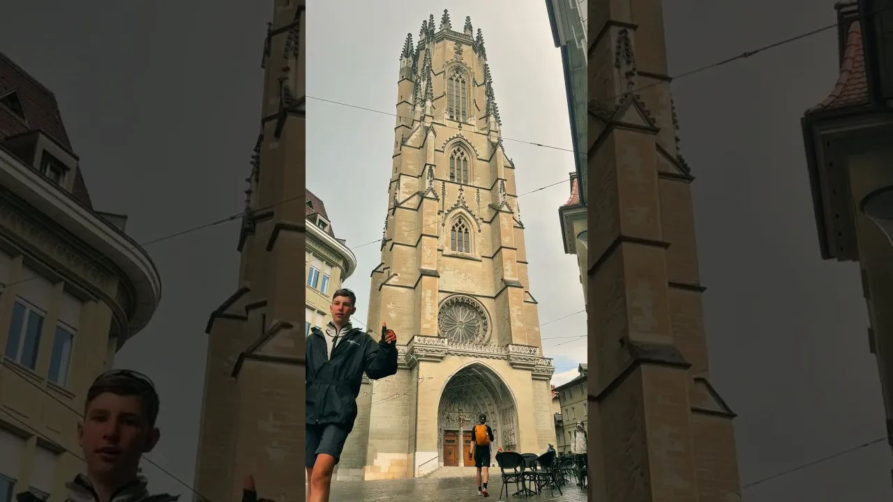 Watch on YouTube
Why Switzerland Is the Ultimate Hiking & Trekking Destination
We, at the Young Explorers Club, pick Switzerland because the numbers translate directly into options and safety for groups of mixed ability. More than 65,000 km of marked trails spread across short day walks, long-distance routes and alpine traverses. Forty-eight peaks rise above 4,000 m, with Dufourspitze topping out at 4,634 m. The Swiss Alpine Club (SAC) operates around 150 mountain huts, and many private and municipal huts fill the gaps. Summer hiking runs mainly June–September, with valley temperatures typically 15–25 °C and high alpine (2,000 m+) around 0–10 °C.
Why those figures matter
-
The sheer trail density lets me build routes for kids, families or hardened trekkers without repeating the same path. I can switch to lower-altitude options if weather or fitness demand it.
-
The 4,000ers bring technical exposure. Routes near those summits often need glacier travel skills, rope teams, crampons and crevasse awareness. That raises objective risk compared with lower alpine trails, so I plan training and guided support on those days.
-
Huts change logistics. With SAC-managed and private huts along the main corridors, I can stage multi-day high-alpine routes without carrying full expedition loads (Swiss Alpine Club (SAC)).
I use hut-to-hut connections for longer itineraries; for family trips I reference hut-to-hut hiking to pick sensible daily distances and kid-friendly nights.
Planning notes and practical tips
Use the following checklist when you plan summer trips:
-
Start early for summit or ridge days. Afternoon thunderstorms peak in July–August.
-
Expect lingering snow on high passes in June and possible late-season snow above ~2,500 m. July–August is lowest-snow; September can bring cold nights and first flakes.
-
Factor in gear for mixed conditions: layered clothing, crampons and a lightweight ice axe if crossing high passes. Consult advice on hiking safety for group risk management.
-
Watch crowds and costs: July–August is busiest and most expensive; June and September are quieter and often cheaper while still offering great conditions at moderate altitude.
-
Build contingency plans around huts and lower-altitude alternatives, and book SAC huts early on popular routes (Swiss Alpine Club (SAC)).
I design routes that match group skills, season and weather windows. That way I keep days scenic, safe and achievable.
https://youtu.be/MR55ll62dqs
What Makes a Summer Camp ‘Best’ — Selection Criteria and Sustainability
We at the Young Explorers Club judge camps by measurable safety, instructional quality and low environmental impact. Age bands, group structure and leader ratios set the baseline. Age bands are usually youth 8–17 and adults 18+. Typical group size runs 6–12 participants per group. Leader-to-participant ratio targets sit at 1:6 to 1:10 for general and trekking groups, and 1:4–1:6 for technical or glacier trips.
Core selection criteria — what we check
Below are the practical criteria we require before signing a camp off:
- Guide qualifications: IFMGA/UIAGM or Swiss Mountain Guide certification (or an equivalent national mountain guide license).
- First-aid standards: Wilderness First Responder or equivalent for leaders on multi-day and remote trips.
- Safety planning: documented emergency response plan, clear evacuation procedures and daily weather monitoring.
- On-route safety gear: leaders carry PLB/GPS, maps and a communication plan with local emergency services.
- Group metrics: daily distance 8–20 km and elevation gain 500–1,400 m/day, adjusted by route grade and participant fitness.
- Trip grading: camps use the Swiss hiking scale T1–T6 to match route difficulty to group ability.
Logistics, grading and sustainability rules
We expect camps to list accommodation types clearly — mountain huts (SAC/private), tents, alpine chalets and youth hostels are common, and many multi-day runs use hut-to-hut hiking as the default. The Swiss hiking scale T1–T6 gives quick clarity:
- T1: easy flat walks.
- T2: marked trails.
- T3: exposed mountain trails.
- T4: where hands are needed.
- T5: difficult alpine terrain.
- T6: very exposed technical routes.
Match a group’s fitness to the grade and plan shorter distances or lower elevation days for younger participants.
Safety metrics that must be verifiable include PLB/GPS on leaders, evacuation access points, route contingency plans and a documented weather-update protocol. Legal and sustainability rules are non-negotiable: follow Leave No Trace, obey seasonal restrictions in protected areas, respect hut etiquette, and note that wild camping is restricted in many parks. We also look for clear insurance coverage and local permits where required.
When choosing a camp look for these keywords in descriptions:
- group size
- leader-to-participant ratio 1:6 to 1:10
- IFMGA or Swiss mountain guide
- Wilderness First Responder
- T1–T6 grading
- daily elevation gain 500–1,400 m/day
- hut-to-hut
- Leave No Trace
- protected areas

Top Regions to Host a Hiking/Trekking Summer Camp (with quick region metrics)
We pick regions that give clear progression from valley strolls to high-alpine trekking. At the Young Explorers Club we match terrain to skill level, logistics and learning goals. Each area below lists what matters most for camp planning: transport, elevations, hut access, typical temps and signature day treks.
Bernese Oberland (Interlaken / Jungfrau)
We base many beginner-to-intermediate camps here because Interlaken Ost offers excellent rail links and quick access to high trails. Base elevation sits near 570 m, with day routes ranging roughly 1,000–3,500 m and huts around 1,600–3,000 m. Expect valley temps of 15–25 °C and cool alpine conditions near 0–10 °C. Classic day treks include the Kleine Scheidegg ridge, Eiger Trail (T2–T3) and the Faulhorn panorama. Plan for heavy visitor traffic in July–August; we stagger departures and use early starts to avoid crowds. The scenery is iconic and ideal for teaching alpine skills and route-finding.
Zermatt / Valais (Matterhorn region)
We choose Zermatt for high-alpine and glacier-capable programs. Access goes via Visp by rail; Zermatt itself sits at about 1,600 m. Typical hikes run from base level up to 3,800 m, and huts often sit between 1,800–3,500+ m. Summer valley temps usually range 10–20 °C, while glaciers stay near 0–10 °C. Signature outings include Gornergrat panoramas and sections of the Hörnli ridge approach; glacier trekking requires ropework and glacier travel skills. Expect higher costs for accommodation and guiding; we budget accordingly and recommend certified guides for any glacier travel.
Engadin / Graubünden (St. Moritz, Scuol)
We use Engadin for high-valley camps and long-trail options. Rail access through St. Moritz or Zernez keeps logistics simple. Bases sit high (1,700–1,800 m) while common hikes range 1,200–3,000 m; huts fall near 1,600–3,000 m. Temperatures are moderate: valley 10–22 °C, high alpine 0–10 °C. Day treks in the Bernina area and Val Müstair give varied terrain and cultural variety. This region suits multi-day hut-to-hut itineraries and longer acclimatization schedules.
Swiss National Park / Lower Engadin
We favor the Swiss National Park for wildlife-focused, low-impact camps. Zernez is the nearest rail hub. Typical base elevations are 1,400–1,600 m, with hikes mostly 1,500–2,800 m. Huts are fewer; camps use local refuges or youth hostels instead. Valley temps sit around 10–20 °C. Routes emphasize fauna, strict seasonal rules and leave-no-trace practice. We design programs to respect regulations and minimize group impact.
Ticino (southern Switzerland)
We run beginner and mixed-activity camps in Ticino where the climate is warmer and trails are friendlier for younger kids. Rail access via Lugano or Bellinzona works well. Base elevations vary from 200–800 m, with most hikes between 400–2,200 m; huts commonly span 1,200–2,200 m. Summer valley temps often reach 20–28 °C, while high alpine zones stay cool. Val Verzasca and Monte Brè provide sunny, low-valley routes and mixed-activity days that mix hiking with swimming or cultural stops.
Quick region metrics
- Bernese Oberland — Hub: Interlaken Ost; base ~570 m; hike range ~1,000–3,500 m; huts ~1,600–3,000 m; temps valley 15–25 °C, alpine 0–10 °C; key treks: Kleine Scheidegg, Eiger Trail, Faulhorn.
- Zermatt / Valais — Hub: Zermatt via Visp; base ~1,600 m; hike range ~1,600–3,800 m; huts ~1,800–3,500+ m; temps valley 10–20 °C, alpine 0–10 °C; key treks: Gornergrat, Hörnli approaches; note higher costs and glacier access.
- Engadin / Graubünden — Hub: St. Moritz / Zernez; base 1,700–1,800 m; hike range ~1,200–3,000 m; huts ~1,600–3,000 m; temps valley 10–22 °C; key treks: Bernina passes, Val Müstair; excellent for multi-day routes.
- Swiss National Park / Lower Engadin — Hub: Zernez; base ~1,400–1,600 m; hike range ~1,500–2,800 m; fewer huts (refuges/hostels); temps valley 10–20 °C; key treks: wildlife routes with strict rules.
- Ticino — Hub: Lugano / Bellinzona; base 200–800 m; hike range ~400–2,200 m; huts ~1,200–2,200 m; temps valley 20–28 °C; key treks: Val Verzasca, Monte Brè; great for beginners and mixed programs.
We often pair higher-altitude regions with a lower valley day for recovery and skills practice. For multi-day hut travel we recommend reviewing our guidance on hut-to-hut hiking so leaders can plan realistic daily distances and acclimatization.
https://youtu.be/MutNdlfq42Q
Sample Camp Profiles, Costs & What to Compare
We, at the Young Explorers Club, operate and recommend a range of trek-focused summer programs that fit different ages and ambitions.
Alpine Youth Trek Camp — Grindelwald, Bern (Bernese Oberland)
We accept teens aged 12–17 for one-week sessions running June–September. Prices range CHF 700–1,200 per week and include accommodation, most meals, and guide fees; extras are travel to the start point and personal gear rental. Groups are small: 10 participants with a 1:6 leader ratio. Hikes average 8–12 km per day with 500–900 m ascent; trail grades T2–T3, so moderate fitness is required. Nights are in SAC huts and mountain chalets at roughly 1,800–2,200 m. A 20–30% deposit secures a booking; refunds get stricter within 14 days of the start date.
Adult Guided Hut-to-Hut Week — Zermatt (Valais)
This 7-day, July–August offering is for adults 18+. Expect CHF 1,200–2,000 per week covering hut bookings, half-board and guide fees; lift passes, transfers and equipment rental are extra. Groups run 8–10 participants with a 1:6 guide ratio. Daily distances sit at 10–18 km with 700–1,200 m ascent and hut altitudes of 2,000–3,200 m. Difficulty ranges T3–T4 and may include glacier approaches, so good fitness and prior alpine experience are required. Deposits are 20–30%; peak-season cancellations often become non-refundable within 30 days.
Budget Day-Camp & Intro Trek — Ticino (Lugano area)
This is a beginner-friendly option for ages 8–16 (youth) and 18+ for adult day-camps. Choose day camps or a 1-week program from June–September. Day-camp weeks cost CHF 300–700; a basic residential week runs CHF 600–900 (meals and day-guides included; hut nights may add costs). Groups are larger (12–16 participants) with a 1:8 guide ratio. Expect 6–10 km per day and 300–700 m ascent on T1–T2 trails. Accommodation uses chalets and youth hostels, with occasional hut nights around 1,200–1,800 m. I recommend reading a short primer on Hiking safety before sending younger children out on multi-day trips.
What to compare when booking
Below I list the quick, practical comparisons and typical inclusions you should weigh before committing.
Price vs Difficulty vs Altitude vs Group size (quick comparison):
- Budget day/week: CHF 300–700 — Difficulty T1–T2 — Altitude low–medium — Group size large (12–16)
- Residential youth hut-to-hut: CHF 700–1,500 — Difficulty T2–T3 — Altitude medium (1,600–2,200 m) — Group size medium (8–12)
- Adult guided high-alpine: CHF 900–2,000 — Difficulty T3–T5 — Altitude high (2,000–3,800 m) — Group size small (6–10)
Typical weekly price bands and inclusions:
- Expect CHF 600–1,800 per week depending on level and what’s included.
- Standard inclusions: hut/bed, most meals (half- or full-board), guide fees, group first-aid kit and route planning.
- Common extras: travel to/from the start, lift/gondola passes, equipment rental (boots, crampons, harness), personal insurance, and hut fees when not included.
Deposit and cancellation norms:
- Deposits commonly 20–30% at booking.
- Cancellation penalties rise sharply as the start date approaches; peak-season trips tend to have tighter refund windows.
Use these comparisons to match a program to fitness, experience and budget. I advise checking exact hut altitudes and daily vertical gain against the party’s fitness. Also confirm whether guide ratios are front-line leaders or include support staff.

Sample Itineraries & Daily Metrics (Beginner → Advanced)
We, at the Young Explorers Club, lay out three progressive itineraries so groups can choose the right challenge and measure daily load against skill and fitness. Beginner, Intermediate and Advanced options each include clear daily metrics, typical terrain notes and practical alternatives for bad weather or low snowlines.
Beginner — 7-day hut-to-hut loop (Bernese Oberland)
Beginner groups follow a Grindelwald → First hut → Männlichen hut → Lauterbrunnen loop with comfortable hut nights at 1,600–2,200 m. Typical daily metrics are 6–12 km/day, 300–700 m ascent/day and 4–6 hours/day. Trails are largely T1–T2, well waymarked and have minimal exposure. Inevitable rain or heavy fog prompts a lower-valley day hike and a chalet overnight as a safe alternative. We encourage booking a hut-to-hut hiking experience early in the season to secure classic beds and timetable flexibility — see our guide on hut-to-hut hiking for family adaptations.
Intermediate — 7–10 day alpine trek (Engadin / Bernina)
Intermediate routes span Pontresina, Diavolezza pass, Chamanna Coaz and Morteratsch with daily metrics of 10–18 km and 700–1,200 m ascent. Alpine passes can reach 2,800–3,200 m depending on the chosen line. Expect T3–T4 sections, occasional scrambling and snowfields in early summer; nearby glaciers may be visible but won’t always be crossed. Weather-driven reroutes include valley-stage days or using cable cars to bypass exposed passes while keeping mileage and ascent within training targets.
Advanced — 3–7 day technical loop (Zermatt / Matterhorn region)
Advanced programs target high-alpine objectives that demand glacier travel, exposed ridges and mixed rock/ice moves. Daily metrics run 12–20+ km with 900–1,400 m ascent and long 7–9 hour days on harder stages. Teams must use crampons, ice axe and rope; IFMGA or Swiss mountain-guide leadership is required with typical guide ratios of 1:4–1:6. For groups wanting high exposure but reduced objective risk, we offer lower-altitude T3 ridge options and valley transfers that avoid crevassed approaches.
Sample day sequences and what to expect
Below are compact sample stages for each level so leaders can plan pacing, kit and contingency options.
-
Beginner 7-day example (Bernese Oberland loop)
- Day 1: Grindelwald → Hut X — 8 km, +450 m, 4.5 h (well-marked trails, minimal exposure).
- Day 2: Hut X → First hut — 6–10 km, +300–600 m, 4–5 h.
- Day 3: First hut → Männlichen hut — 7–12 km, +350–700 m, 4–6 h.
- Final day: Männlichen hut → Lauterbrunnen (loop return) — 6–10 km, descent-focused.
-
Intermediate 7-day sequence (Engadin / Bernina)
- Day 1: Pontresina → Hut A — 12 km, +800 m, 5.5 h.
- Day 2: Hut A → Pass B → Hut C — 14 km, +1,100 m / −900 m, 6–7 h (possible scramble and snowfield).
- Day 3: Hut C → valley descent → Transfer — flexible lower-altitude day for recovery or logistics.
-
Advanced 3–7 day high-alpine loop (Zermatt)
- Day 1: Zermatt → Hut X — 14 km, +1,200 m, 6–7 h (glacier approach).
- Day 2: Hut X → High Pass (≈3,100 m) → Hut Y — 16 km, +1,400 m / −1,000 m, 7–9 h (glacier travel, roped sections).
- Day 3: Hut Y → Zermatt descent — 12 km, +400 m / −1,600 m, 5–7 h.
Operational notes and practical tips
We set daily targets conservatively to allow for weather, group pace and photo breaks. Leaders should ready these items for each level:
- Navigation: map + altimeter and pre-loaded GPS track for technical stages.
- Safety kit: basic first aid for beginner, full crevasse rescue kit for advanced.
- Time buffers: plan for 20–30% more time on transit days in poor visibility.
We determine guide ratios, kit lists and route choices before departure and adapt them each morning based on condition reports.

Safety, Medical & Gear Essentials
We, at the Young Explorers Club, set clear standards so each hike and trek runs safely and smoothly. Guides on technical or high-alpine routes must hold IFMGA/UIAGM or Swiss Mountain Guide Association certification. Trip leaders carry Wilderness First Responder (WFR) training or an equivalent qualification. All other staff hold at least a basic first-aid certificate and practice regular drills.
I keep emergency systems and insurance front and center in planning. EU-wide 112 and Swiss mountain rescue 144 are the primary emergency numbers we teach participants to recognise. We require every participant to hold private travel insurance that explicitly covers mountain rescue, helicopter evacuation and medical repatriation. Youth camps must provide proof of insurance and return a parent-signed waiver before departure.
Altitude is part of Alpine life, so I manage acclimatisation carefully. Most of our routes stay below 3,000 m, but any itinerary that crosses 2,500 m triggers a formal acclimatisation plan. Leaders monitor for AMS symptoms and adjust pace or descend at the first sign of trouble.
Weather and objective hazards dictate how each day starts. Thunderstorms peak in the afternoons in July and August, so we favour early starts and build contingency plans. Groups get briefings on rockfall, loose terrain and crevasse risk where relevant. I instruct leaders to check mountain-specific forecasts each morning and to change the route if conditions demand it. For child-focused safety guidance see hiking safety.
Every trip runs with a written emergency plan. Key items I enforce include:
- Personal locator beacon (PLB) and GPS carried by the leader, with charged spares.
- Daily weather briefings and pre-route hazard checks.
- Prearranged evacuation access points and clear transport plans for stretchers or heli pick-up.
- A simple incident-reporting chain and local rescue contact list kept with the group manifest.
I make gear policies transparent before participants arrive. Camps must state which items they supply—sleeping-bag liners, technical kit, helmets or harnesses—and which items participants must bring or rent locally. I also request the provider’s incident history and average local rescue response times when assessing safety systems.
Gear checklist: mandatory, technical and recommended
Below is the kit I expect for general hiking and trekking; I list technical extras separately and add sensible optional items.
Mandatory (typical)
- Sturdy hiking boots (well broken-in) — 1 pair.
- Layering system: 2 base layers; 1 warm layer (fleece or down); 1 waterproof shell.
- Daypack 20–35 L for single-day routes; 35–50 L backpack for multi-night treks.
- Headlamp plus spare batteries.
- Map, compass and altimeter or GPS; leader carries the primary navigation device.
- Water bottle / hydration system with at least 2 L capacity recommended.
- Sun protection SPF 30+, sunglasses (Category 3) and a sun hat.
- Personal first-aid items and blister care.
Technical / route-specific mandatory items (glacier or technical routes)
- Harness, crampons, ice axe, helmet and rope. I always specify whether the provider supplies these or whether participants must bring or rent them.
Optional / recommended extras
- Trekking poles for load reduction and knee protection.
- Water purification tablets or a lightweight filter.
- Emergency foil blanket and a spare warm hat and gloves.
- Spare batteries and a small repair kit for boots or poles.
I advise clear rental options in pre-trip communications so families can avoid sourcing specialised kit at short notice. We also recommend participants test boots and backpacks on local walks well before camp; proper fit and comfort prevent most injuries.


